Barney McLean
Chauncey Thomas memorial

National Lands

.

National Lands Articles

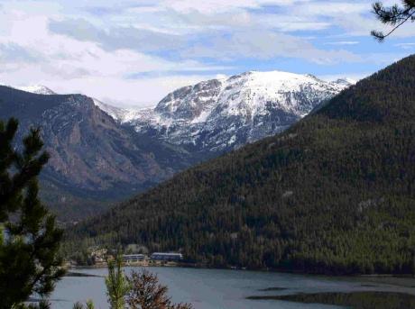
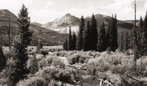
Rocky Mountain National Park

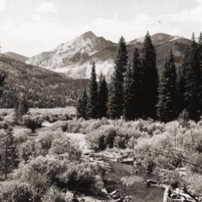
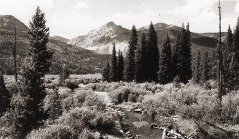
In 1915, thanks to the efforts of visionary Enos Mills, Rocky Mountain National Park became the 10th national park. The concept was then, and still is, conservation of natural lands and wildlife. No commercial enterprises which consume resources operate within its boundaries--no logging, grazing, farming, mining, hunting or trapping.

Almost all private property in-holdings have been bought by the National Park Service and the buildings destroyed. Located within park boundaries, Longs Peak, at an altitude of 14,256 feet, named for explorer Stephen Long, is visible from both sides of the Continental Divide. Indeed, one can look northwest along 17th Street in Denver, to see one of the area’s best known peaks.

Trail Ridge Road, which runs through the park, was completed in 1932 and is the highest continuous highway in the United States. It is open only in the summer. Dignitaries from the towns of Estes Park and Grand Lake celebrate the opening each year, often but not always by Memorial Day, with a ceremony at the top called “Hands Across the Nation.”

Articles to Browse

Topic: Mountains

Mount Craig

The rounded mountain at the head of the East Inlet to Grand Lake has born many names-from Middle Mountain, to Mount Baldy, to Mount Westcott. It's official title, however, is Mount Craig. It's namesake is The Reverend William Bayard Craig, who came to the area in 1882, to be pastor of the Central Christian Church in Denver. He visited Grand Lake occasionally, and completed some real estate dealings there. The town of Craig also bears his name, due to the influence of his friend, David Moffat, of the Denver and Salt Lake Railroad.

Topic: Water

Water from the Mountains - The Grand Ditch

 Though few, high altitude water ditches have had a major impact on Grand County's history and economy, there were many early valley ditches transporting this precious commodity from water-right sources to the owner's ranch. However, the threat of transporting great volumes of water from our county to Boulder County via high altitude ditches appeared back in 1889.  Certain interests east of the Divide talked the Legislature into appropriating $25,000, for surveying and developing a 20-mile-long canal over South Boulder Pass to South Boulder Creek.  Amazingly, neither Grand County residents nor very many others opposed this notion.  Luckily the state engineer found the terrain so difficult that not even $2000 was ever spent on the project.


The next effort occurred also in 1889.  This privately financed plan was to develop a two-branched canal system that would move 700 second feet of water to a half-mile tunnel just beneath Berthoud Pass at over 11,000 feet, thence down to Clear Creek and on to the Golden area.  Initial surveys were begun that fall and roads laid out the following year.  The effort bogged down but was resurrected in 1900 under the Agricultural Ditch Co., supplemented in 1902 with the Berthoud Canal Co.  The canal was partially completed by the Frank Church family ranching interests of Jefferson County by 1906.  The ditch, which can be walked today, runs from Second Creek to Berthoud Pass, though it no longer carries much water.  However, the Church Ditch water rights coming from Clear Creek still exist and today are owned by Northglenn.

Proposed in 1890 by the Water Supply and Storage Company of Fort Collins, a greater canal was to be built 1000 feet above the Kawuneeche Valley, that would tap the high tributaries of the North Fork of the Grand River, sending the water over Poudre Pass to a reservoir and then into the Cache La Poudre River and on to agricultural areas east of the Front Range.  The water company, later known as the Grand River Ditch Company, appropriated 525 second feet at the time of the initial diversion in 1892.  (When the Grand River was renamed the Colorado River in 1921, the company was changed to the Grand Valley Irrigation Company.)  The ditch was dug by hand, primarily by Japanese and Mexican laborers.  By 1900, water was flowing eastward.  

By 1906, this major canal, known as the Grand Ditch, and draining water from the Never Summer Range, had a capacity of nearly 358 second feet with 12 headgates within 8 miles, running from Baker Creek to the pass at 10,179 feet, plus a smaller canal carrying 183 second feet within 11 miles, coming from Specimen Mountain.  In 1936, using machinery, the ditch was lengthened to 14 miles.  The Grand Ditch is about 20 feet wide and 6 feet deep, though the water is rarely more than 3 feet deep, and this water irrigates some 40,000 acres in Weld and Larimer counties.

The National Park Service has argued against the allocation of all this water to the canal as it is needed to support plant life and animal habitat.  Becuase river water flow was cut in half, the immediate effect was a reduction in the fish population in the Colorado River.  More recently, a major washout in the ditch caused devastating damage to the slopes below the ditch and to the Colorado River itself.  Hikers climbing up from the valley use the Grand Ditch as a route to the high peaks and lake.  But as viewed from below, the Grand Ditch is often considered an ugly scar on the landscape.

Topic: True Crime

Spider House Tragedy

Nestled on a quiet lane in Old Grand Lake City sits the intricately crafted home of Warren C. and Mary O’Brien Gregg, known today as the Spider House – a testament to a remarkable woodcraftsman and his tormented wife.

Warren (Watt to his friends) was a dreamer and in the 1870s he left his first wife and a young son in Wisconsin and headed for the Colorado Territory seeking his fortune in the mines of Gilpin County.  Upon returning to Wisconsin his first wife died of fever, leaving Warren a widower with a small son.  Holding tight to his dreams of the west, Warren eventually ended up in his native Indiana where he met and married 20 year-old Mary O’Brien, in 1884.   By 1888 Warren packed his new family into a prairie schooner and headed west.  Like so many other pioneer women before her, Mary bore a child along the trail, a second son whose short life would send Mary down a dark and tortured path. 

The family arrived in Middle Park late in the summer of 1888, built a small homestead on the eastern slope of the Stillwater drainage and the newborn died shortly thereafter.  Though the years would bring more children, Mary would never quite recover from the loss of her second son. They continued to scratch out a living in this harsh and isolated land, where winters were long and supplies were meager. 

Warren spent much of his time searching for game and exploring this new country. The Gregg’s moved numerous times, finally purchasing a plot of land from Old Judge Wescott on the west side of the lake.  Warren built his family an admirable house, with intricate detail and spider-like webs of wooden elements.  Despite the warmth and comfort of this new home, and the close proximity of neighbors, Mary’s depression deepened. 

Then on a sunny Sunday in 1904, while Warren was working in his woodshop and oldest son Lloyd was having Sunday dinner at Judge Westcott’s, Mary took a gun to her four remaining children and then turned the weapon on herself.  The children died instantly while Mary lingered on for four days.  The five victims of this tragedy, one girl, three boys and Mary herself are buried together in one grave in the Grand Lake Cemetery.

Warren lived in the Spider House for another 29 years. With his son Lloyd, he continued building homes and stone fireplaces.  He succumbed to heart failure in 1933.  Mary O’Brien Gregg finally found peace in the quiet grace of the little town cemetery surrounded by her children.  Almost a century later, as the tall pines whisper their mournful winter song, the Spider House still sits nestled on that quiet little lane.

Topic: Biographies

William H. Kimball

The span crossing the Colorado River on State Highway 9 southeast of Kremmling is known as the Kimball Bridge.  It honors the memory of William H. Kimball who carried the mail over Berthoud Pass from Empire to Hot Sulphur Springs by foot, winter and summer.  Kimball was born in Maine and accepted the Middle Park mail contract in 1875.  Although reportedly nearly blind, Kimball traveled on snowshoes all winter carrying a backpack of mail weighing 70-105 pounds, day and night, at least once a week.

In  1884, Kimball established a flat bottom ferry over the Colorado River near the spot where the bridge now stands.  Before that time, no wagons could cross at that area.  With the addition of the ferry, load of game meat and fish could be taken up the Blue River to be traded for much needed staples. 

Kimball never married and lived at a nearby ranch until his death in 1909.

Topic: Regions

Fraser Valley

The principal population centers in the Fraser River Valley are Winter Park, Fraser and Tabernash.  When the early stage coaches came over Berthoud pass into the Fraser Valley, the most popular stop was at the Cozens Ranch, which now houses a historical museum in Winter Park. The valley is now bisected by U.S. Highway 40, which was designated the "Victory Highway" in 1931.  The new route of the highway leads through the main streets in both Fraser and Tabernash and the backdoors of some business became front doors because of the new highway alignment.   

Tabernash was the name given to a railroad siding, named for the Ute leader who was killed during a confrontation with local ranchers.  The town became a key station on the railroad line, and included a roundhouse, and a supply of helper engines for the steep climb over Rollins Pass.  When the Moffatt Tunnel was opened in 1928, the railroad no longer needed service there and the town lost its' main economic support.

George Easton founded the town site of Fraser in 1905.  The rest of the country became familiar with Fraser when the winter temperatures were often the lowest recorded in the U.S. and Fraser was know by the nickname "Icebox of the Nation".   Lumbering was one of the prime industries in the region until World War II.  During the war, the military built a Prisoner of War camp at Fraser to help lumber for the mills in the area.

The current area of Winter Park has had many names over the years.  First it was called simply "Old Town" or "Vasquez", named after the fur trader Louis Vasquez.  "Woodspur" or "Woodstock" referred to Billy Wood's lumber mill in the area, which furnished ties for the railroad while it was being built over Rollins Pass. During the construction of the Moffatt Tunnel, the name "West Portal" came into usage.  Rail workers also called the community "Little Chicago" as it was as it was a favorite gambling, saloon, and brothel site.  As tourists began to arrive it was known as "Idlewild" and also "Hideaway Park".  Finally, the name "Winter Park" was settled upon to correspond with the adjacent ski area of the same name.

The area population declined from 1232 people in the 1920's to only 373 people by 1930.  The Great Depression ended the construction boom and the price of beef became too low for ranches to turn a profit.  However, since that time, the area has thrived, mostly based on a tourism economy.  The valley's main source of income is now recreation and second home construction. 

Topic: Ranching

Murphy Family Ranch

Article contributed by Tonya Bina of Sky Hi Daily News, October 2009


As late as this summer, John Murphy, 94, mowed ditches on his ranch land and built a new fence. "You got to keep busy doing something," he said.
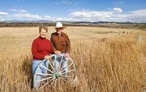
His longevity, he said smiling at wife Carolyn across the table, is owed to "having a good wife to keep you healthy."

And then he added, "and being stubborn and contrary, I guess." But, Carolyn believes John's secret to healthy aging is due to "hard physical labor from an early age," plus the privilege of being raised where there is good air, little junk food, fresh vegetables, fresh milk daily and ranch-harvested meat. Dancing and regular rodeo jaunts also don't hurt.

This week, the Murphys are pausing to acknowledge a 100-year milestone, when John's parents first bought the ranch in greater Granby. John Murphy was born in the family's white two-story ranch house, which still stands on the property, six years after his parents Anna (Rohracher) and James Murphy bought 160 acres from Leopold Mueller in 1909. He had purchased the land from the widow of Edward Weber, who was one of the Grand County commissioners shot in the Grand Lake shoot-out of 1883. Weber's grave is still surrounded by a white-picket fence, located just northwest from the Murphys' newer home.

Mother Anna had crossed the ocean from Austria in 1882 with her family, then in the spring of 1884, they walked over Rollins Pass from Ward to homestead at Eight-Mile Creek south of Granby. The town of Granby didn't sprout until the railroad came through in the early 1900s, so twice a year, the family would travel over Berthoud to Georgetown to buy groceries - a testament to the fortitude people had back then. "How often do you go for groceries now?" John asked. "Twice a day?"

Anna and James married in March of 1907 and had three children: Margaret, James and John. When John was just two years old, his father died and his mother was left to care for the ranch and the three young children. She later married Joseph Reinhardt who had the ranch above theirs.

Upon her death in 1952 at the age of 75, "The Middle Park Times" saluted Anna for having been "a hardy pioneer woman" who prided herself for her ability to horseback ride and milk cows, and called the latter a "fine art rather than a chore."

"It was a pleasure for her to sit down and milk cows," John said. "That's when she could rest. She would milk half of the cows while me and my step-dad milked the other half."

The ranch had about 35 cows, and the cream and milk they produced was shipped to Denver where it was sold. When the lettuce colonies came to the Granby area around the early 1920s, the Murphy ranch prospered selling milk and butter to local settlers.  "Where the airport is now, there was a shack or tent on every 10 acres over there," he said, "and five packing warehouses along the railroad." Even a section of Murphy land was leased to grow lettuce and spinach.

When young boys, John and his brother would sometimes find entertainment riding on the backs of calves in the barn - always out of sight from their mother who would have disapproved, he said. And the younger John would horseback to the Granby schoolhouse located across from the present day Granby Community Center.

Back then, Granby was barely a settlement, and the Murphys' closest neighbor was farther than a mile away. Granby, especially, has grown in the past 20 years, threatening the lifestyle he has known all his life. In the past, ranching families made up the community, and neighbors looked out for one another, he said. "There was kind of a togetherness," he said. "Now we don't have that."

Nodding to the golf courses and newer homes surrounding Granby proper, "We're losing it, losing all the ranchers," he said. "Like any piece of property, I hate to see it change hands, but progress happens and there's nothing you can do about it."

John Murphy began running the ranch in 1934 and his older brother James ran another ranch near Fraser, land the brothers originally had purchased together.
John's first wife Edith died during childbirth, and John became a single dad to a daughter and son who were 2 and 4 years old at the time, running the ranch and raising his children like his own mother did when he was a toddler.

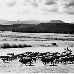
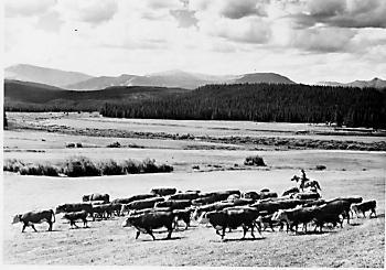
At its height, John Murphy's commercial cattle operation had about 2,000 acres and about 120 pair of cows and calves, with the calves selling at the top of the market in Omaha. John said from working his land for hay through the years, he has found buffalo horns. "There must have been quite a few buffalo here in the 1800s," he said. The land has since been leased, split, and some shared with John's family, including daughter Jennifer Baker and son Steve Murphy.

Although the winters are no longer as harsh as he remembers them - "It would get 30 to 40 below for the whole month," he said - he and wife Carolyn now winter in Arizona. John met Carolyn in the 1970s, and the couple would dance at haunts such as the Circle H and Hazel Mosle's (now Johnson's Landing). "I just held the girls, and they did the dancing," John said. "She complained I held her too tight," he said, of Carolyn. "And she's been suffering every since."


Topic: Places

Place Names

Article contributed by Kathy Zeigler

The County of Grand was established in 1874, taking its name from the Grand River which has its headwaters in the county, and from Grand Lake, the largest natural body of water in the state of Colorado.  The county seat is Hot Sulphur Springs.  The area of the county is 1854 sq. mi., making it larger than the state of Rhode Island.

Fraser was established in 1871 as the town of Eastom.  Its name changed to Fraser, after the river that flows through the town, though it was originally spelled Frazier, for Reuben Frazier. The Post Office adopted the simpler spelling at the establishment of the Post Office.  The town bore the distinction of being the "icebox of the nation" for many years, losing that title in a legal battle with a town in Minnesota.

Granby was established in 1904, taking its name from Granby Hillyer, a Denver attorney who may have been associated with the founding of the town.

Grand Lake was established in 1881 as a mining settlement by the Grand Lake Town and Improvement Company, taking its name from Grand Lake.

Hideaway Park was established approximately 1905, and named for its hidden location with the trees screening it from the road. It may have been earlier known as Woodstock, Vasquez and Little Chicago. Max Kortz, owner of a dance hall in the village is said to have provided the moniker. 

Hot Sulphur Springs was established in 1860 and named for the hot springs.  It may have been refered to as Sulphur Springs in its earliest days, and as Sulphur by the workers and management of the Denver and Salt Lake Railroad when it came through in 1904.

Kremmling was established in 1881 as a general merchandise store, owned by Kare Kremmling on the ranch of Dr. Harris, located on the north bank of the Muddy River. In 1888 John and Aaron Kinsey had part of their ranch platted, calling the site Kinsey City. Kremmling moved his store across the river to the new site; eventually the town came to be known as Kremmling.  (Note the two different first names-Reuben Kremmling and Kare Kremmling.  I'll keep working on that discrepancy.)

Radium's name was suggested by Harry S. Porter, prospector and miner, in reference to the radium content in one of his mines.

Winter Park was first known as West Portal, a settlement that grew up during the construction of the Moffat Tunnel in the 1920s.  Postal authorities agreed to the name change to Winter Park, after a request was made by Denver mayor Benjamin F. Stapleton and many sport enthusiasts to publicize the establishment of a top winter sports area.

Berthoud Pass, el. 11314, was named for Capt. Edward L. Berthoud. Berthoud discovered the pass in 1861. He was also chief engineer on the Colorado Central Railroad.

Gore Pass, el. 9524, was named for Sir Charles Gore, who mounted a monumental "hunt" to the American West during the 1850s. Gore spent considerable time in the area, and gave his name to the Pass, a mountain range, and a canyon.

Milner Pass, el. 10759, was named for T.J. Milner, and accomplished civil engineer for railroads and street car lines.

Muddy Pass, el. 8772, bears the name of Big Muddy Creek, a tributary of the Colorado River, with reference to the muddy appearance of the waters during the spring runoff and storms.

Rabbit Ears Pass, el. 9426, refers to Rabbit Ears Peak, whose outcroppings somewhat resemble a rabbit's ears.

Willow Creek Pass, el 10850, is named for the stream, and almost certainly for the willow bushes that line the banks of the stream. The pass was a well known Indian trail, and became a road in the early 1900s.

Source: Eichler, George R. Colorado Place Names. Boulder: Johnson Publishing, 1977.
Topic: People

The Knight Ranch and Charles Lindbergh

In Grand County during the 1920's, you might have been lucky enough to have taken a plane ride over Grand Lake with Charles Lindbergh.  It may sound preposterous, but Gordon Spitzmiller and his father, Gus, were two of the many fortunate people who got private sightseeing tours over the Grand Lake area with Charles A. Lindbergh as tour guide.

In the early 1920's, the aviation industry was a brand new field open to the adventurers, the thrill seekers and the adventurous.  Charles Lindbergh was one of those men.  In the spring of 1926, Lindbergh had the dream of flying solo over the Atlantic Ocean, from New York to Paris nonstop.  He was a determined man and was resolved to be the first man to cross the Atlantic and win the Orteig Prize.

On May 22, 1919, Raymond Orteig of New York City offered a prize of $25,000 "to be awarded to the first aviator who shall cross the Atlantic in a land or water aircraft (heavier-than-air) from Paris or the shores of France to New York, or from New York to Paris or the shores of France, without stop."

Besides Lindbergh, there were four serious contenders for the Orteig prize, one of which was Commander Richard Byrd, the first man to reach the South Pole.  Lindbergh's courage and enthusiasm for such a flight were not enough; he needed financial backing.  Lindbergh found his financial answer in Harry H. Knight, a young aviator who could usually be found bumming around the Lambert Field in St. Louis.  This was the beginning of the Knight-Lindbergh partnership that would soon change the course of aviation history. 

After being denied any financial assistance by several of St. Louis's businessmen, Lindbergh made an appointment with knight at his brokerage office.  Knight, the president of the St. Louis Air Club, was fascinated with Lindbergh's plan and called his friend, Harold M. Bixby, president of the St. Louis Chamber of Commerce.  Bixby also displayed a strong interest in the obscure stunt flyer and mail pilot.  Together Knight and Bixby formed an organization called "the Spirit of St. Louis", which was dedicated to gathering funds for the flight.  More than $10,000 was needed in order to build a single engine plane and acquire the proper equipment.

Knight went to his father, Harry F. Knight, who was a major power in the realm of finance and an equal partner in the firm Dysart, Gamble & Knight Brokerage Company.  Like his son, the senior Knight was interested in the aviation field and backed every effort to make America conscious of airplane transportation.

Without the financial aid and moral support offered by the Knight family, Charles Lindbergh may not have been able to cross the Atlantic in 1927.  Lindbergh's gratitude to these two men never ebbed.  Lindbergh and, his famous wife Ann Morrow, came often to Grand County as guests of Harry F. Knight whose ranch encompassed 1,500 acres on the South Fork of the Colorado River.  The ranch today is covered by the waters of the Granby Reservoir.

Knight, a nature lover, spent much of his time at this ranch.  It was a haven for sportsmen and adventure seekers, and Lindbergh was a natural for these two categories.  One of the largest and best airstrips in the west was added to the Knight Ranch in order to accommodate the owner and his guests.  Besides the airstrip, the ranch boasted a miniature golf course, a 28 room estate, a private guest "cabin", a good selection of livestock and an array of entertainment that would suit all.  It was a sanctuary for the affluent.

Local people were so enthused about the handsome aviator that they named a 12,000 ft. peak in the Indian Peaks Wilderness Area (east of Granby) "Lindbergh Peak". However, during the 1930's the hero was honored by Adolph Hitler and Lindbergh made a speech favoring Nazism.  This lead to a fall from grace in the eyes of the public.  Even though Lindbergh changed his mind as World War II began, it was too late to regain his former popularity. The peak was renamed "Lone Eagle Peak" which was a nickname for the famous aviator.

After Harry F. Knight died of coronary thrombosis in 1933, his son, along with ranch manager Harry Morris, turned the ranch into a major breeding and beef cattle operation.  It continued as such until 1948, when the Knights were asked to sell it to the federal government or have it condemned to make way for the reservoir.  Moss bought out the cattle operation and most of the buildings were sold, but the colorful memories of the Knight ranch were buried in the depths of Granby Reservoir.

Topic: Regions

North Park & Middle Park - Politics and Whiskey

The Territorial legislature defined the boundaries and county seats for the West Slope in 1861.  Geographic knowledge of the Colorado mountains was somewhat limited at that time.  North Park (a name now synonymous with Jackson County) was an Indian hunting ground and little was known about it.

A boom started with the discovery of gold and silver at Teller City in 1879.  North Park was considered to be part of Grand County, and now there was property to assess and tax.  The Grand County road tax in North Park for 1881 applied only to males between the ages of 21 and 45.  They had to either pay $3 in cash or do two day's work on the roads. John Mills, a Teller City resident who acted as an attorney for mine owners, served as a Grand County commissioner and was one of the commissioners killed in the July 4, 1883 gun battle at Grand Lake.

As ranches became established and more mineral deposits were discovered, the Larimer County commissioners began to speculate that the "Snowy Range" that defined the western boundary of Larimer County was the Park Range on the west side of North Park rather than the Medicine Bow Range.  This opinion soon degenerated into a dispute between Grand and Larimer counties, ultimately ending up in court. In 1886 the Colorado Supreme Court ruled that North Park was part of Larimer County.

A trip to the county seat in Fort Collins was a considerable undertaking.  If everything ran on schedule it was possible for travelers to leave Walden on the morning stage, catch a train from Laramie to Cheyenne, another train from Cheyenne to Greeley, still another from Greeley to Fort Collins, and arrive at the county seat before closing hours the following day.  The fares amounted to a significant expense.  It was probably more common for a North Parker to travel to Fort Collins in his wagon, take care of business, and come home with a wagonload of provisions.  The trip by wagon took three to four days each way.

As the population of North Park grew, so did the desire to split from Larimer County.  In 1908 the Loveland newspaper stated that Larimer County was too big and advocated a new county with Loveland as the county seat.  The Walden newspaper agreed that the county was too big but felt the wrong division line had been picked, pointing out that "A Loveland man can get to the county seat in three hours anytime, but it takes a North Park man three days most of the time."

Ranchers resisted early efforts to set off the area west of the Medicine Bow Range into a county of its own as they carried the largest part of the tax burden and felt their taxes would increase if a new county was established.  But by 1908 there was general agreement within the Park that it was time for court and administrative offices to be more conveniently located.

The total valuation assessed in 1908 of North Park property by Larimer County was $771,776, which generated $16,979 of revenue.  The salaries of some of the paid officers of the new county was estimated as follows:

     Assessor                                                    $800

     County School Superintendent                   $800

     Water Commissioner, 2 districts                $1000

     County Commissioners                             $1000

Even adding in salaries for the sheriff and county clerk it appeared quite likely that the new county could be operated efficiently without a tax increase and the proposal to create "North Park County" had nearly unanimous support from North Parkers.  The bill passed the legislature easily in April 1909, with a name change to Jackson, and was quickly signed into law on May 5 by Governor Shafroth.

While North Parkers were eager to sever their legal ties to Larimer County in 1909, they clearly weren't ready to give up the pleasures of offered by a nip of the bottle.  Like most frontier areas, North Park had a significant number of single men who liked to occasionally get together and enjoy a few drinks with their friends.  Walden was the center of socialization.  According to an 1899 newspaper article, Walden residents worried about the "toughs" who came to town to "drink barbed-wire bitters and then shoot up the place."

In addition, local married men sometimes frequented the bars when they could have been spending more time at home helping out with domestic chores.  As a result, a strong temperance movement soon divided the community.  One of the two local newspapers, the North Park Union, endorsed the temperance movement in early 1902 and soon found itself the target of a boycott by both advertisers and subscribers.  Although the editor declared it a "boycott of no great magnitude", the paper had a new owner/editor within a month.  The issue of whether Walden should be wet or dry was on the 1902 ballot.  By a very decisive majority, voters decided Walden would continue to be wet.

Just before the 1906 election, the Walden newspaper criticized the local Republican Party bosses for providing a lot of free whiskey in every North Park precinct on election day, and urged North Parkers not to sell their vote for a drink.  The temperance movement enjoyed its first victory when it combined forces with the local church and convinced the businessmen of Walden to close their stores on Sundays.  The closing did not stand in high favor with ranchers.  "When a man can't buy axle grease for his wagon when it runs dry and something else for himself when he runs dry, it is time to call a halt," they declared.  Quite a number of the ranchers started going through to Laramie for their provisions, and the Sunday closing rule was abandoned six weeks after it was implemented.

When news reached Walden in early 1909 that the bill creating Jackson County had cleared the legislature, the newspaper reported that the town was moved to the point of a merry celebration.  The brass band marched, guns were fired, and at daybreak "the women, as becomes their sex, were among the few who were sober."  A few weeks later news that the Governor had signed the bill was cause for another celebration.  The newspaper reported that, "the air about town clouded up and filled with burnt powder and raucous vocalizations.  The festivities continued in the evening with flying anvils propelled by stick powder . . ." The first hundred years of Jackson County had commenced.

Topic: Water

Moving Water from Point A to Point B

Most serious ranchers had more than one ditch and most built one or more reservoirs. Hilry Harris, Munroe C. Wythe, Samuel H. Burghard, and John A. Coulter entered the first water claim in the county on September 20, 1874. This came out of Sheep Creek above the head of Gore Canyon.

There usually was some natural irrigation; but the challenge of getting the water from the creek required laborious construction of diversion dams, headgates, and ditches, the earliest ditches being dug by hand and often taking up to four years to complete. Later, ditches were dug using teams and scrapers. The grade was figured out initially by simple gravity flow, letting a trickle of water move down the ditch. Soon ranchers refined the process, using a 16’ long board placed with a 1/8" slope, determined by a carpenter’s level. A.F. and Roy Polhamus surveyed a great many of the water ditches, especially those impressive ones in West Grand County, some of which even had tunnels involved. Most small ditches supplied just one ranch, but if a ditch had to cross another ranch, that rancher usually got a share. And some of these ditches were long!

For instance, Dr. Henry Hoagland, on the Blue River, anticipated getting water close at hand from Spruce Creek. Instead, he discovered an old timer had previous rights that forced him to go back into the mountains and build a 13-mile long ditch. Hoagland had figured on spending about $7000; in the end, the actual cost was $26,000! His crew dug the ditch around side hills and across valleys using flumes and siphons. Then his real troubles began. Terrible leaks and washouts occurred everywhere. Finally he hauled in adobe and put this in the bottom of the ditch, rented sheep, and drove them day after day up and down the ditch to pack it. After a couple of years of using this tamping process, the ditch held. Other ditches were even longer. The Church Ditch at Willow Creek and the Wheatley Ditch on the back Troublesome were both 16 miles long.

The Company Ditch (aka the Williams Fork Ditch), eight feet wide on the bottom, was another long one. Built between 1903 and 1907, it cost $44,000 and had a decree for 150 cubic feet / second. The ditch went uphill and down, requiring many flumes and bridges. One flume was actually 1200 feet long! Subsequent breakdowns, leaks, and slides were so frequent and repairs so extremely costly that old-timers have said the reason the Company Ranch went broke about 1920 was the expense of The Ditch. The Lyman Ditch (or the Curtis), started about 1891, was just as complicated as the Company Ditch. Crossing high above the Williams Fork River, the ditch eventually needed cement piers to carry the pipe (1928). This ditch had so many slides, leaks, and washouts, that it had to be inspected once or twice daily! Siphons were required over draws. Flumes, sometimes ¼ mile long, might be 25-30 feet high, and one flume was actually 177 feet high; but these heights were necessary to maintain the elevation.

Flumes, being of wood, rotted and were guaranteed to leak. Sometimes wind blew a portion of the flume down. Finally the county put in big pipes to help the ditches across the Williams Fork. It might be noted that, when water leaked out of ditches, a side benefit was that ranchers along the way could use the "lost" water. Along with the ditches came reservoirs.

Fred DeBerard had four reservoirs on the Muddy: the Albert, the Binco, Milk Creek, and a low one that flooded the Jones place near Kremmling. All were dirt, of course. The Hermosa Ranch on the Little Muddy had water rights through the Sylvan Ditch and Reservoir Company and they built the Sylvan Reservoir dam and the Hermosa Ditch starting in 1911 and completing it by the spring of 1916. The Stein Ditch, started in 1897, was another large ditch, this one later purchased by the Taussig family. These ditches were all built originally to provide water to meadows and fields for ranching purposes. For years, people hauled in water for baths and household use, but that gradually changed. Leon Almirall, near the Horseshoe Ranger Station on the Williams Fork, decided that he wanted water for his home, so he built a 1700’ pipeline to his house, added an inside bathroom, and was shocked when the line froze the first winter – it was only three feet deep. He called in workers who dug down and insulated the line with manure and straw. It froze again. Finally, Almirall gave up and buried the line six feet deep. Now he had his water!

On Ranch Creek in the east end of the county, E.D. Shew cut a ditch upstream from his house, placing it along the edge of the creek, but directing the water back into the main channel near his house. At that point, he put a little water wheel that pushed the water up the hill to his cabins -- and furnished electricity besides. Eventually he replaced the water wheel with a gas engine. There was a similar water wheel, used for the same purpose, up in Hideaway Park.

Water was used to transport lumber as well. A flume ran down the mountain into Monarch Lake, in the days when the Monarch Company was timbering there. There was a flume along St. Louis Creek, carrying lumber from the camps upstream. Perhaps the most ambitious flume ran from Western Box Sawmill. This area is now under Meadow Creek Reservoir. In 1906, the Deisher Lumber Company paid Nathan Hurd for a right of way through his land and built a flume with a 2% grade down Hurd Creek. Logs were placed in the flume and a horse harnessed to the last log. The horse then pushed the logs down the flume with the help of the water. Three years later, the mill was moved to "Sawmill Meadow" on Meadow Creek.

In 1911 construction on the seven-mile-long Vaver Flume began, with 117 cubic inches of water allotment. This flume ran down Meadow Creek and over to Tabernash, carrying partially processed logs for further manufacture. A flume rider checked along the way, making sure there were no jams, and phone line allowed the rider to report troubles. Hikers can see remnants of both the St. Louis Creek flume and that one coming down Meadow Creek today.

Error message

  • Notice: Undefined index: quantity in omega_views_mini_pager() (line 234 of /var/www/html/docroot/sites/all/themes/omega/omega/inc/theme.inc).
  • Notice: Undefined index: quantity in omega_views_mini_pager() (line 234 of /var/www/html/docroot/sites/all/themes/omega/omega/inc/theme.inc).

National Lands